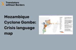
View in a new tab and download our Mozambique Cyclone Gombe crisis language map as a photo here. Cyclone Gombe’s intense winds and heavy rains have been causing death and destruction in Madagascar and Mozambique since March 7, 2022. As of March 12, 2022, an estimated 900 people have been affected across the two countries. […]
A framework for the ethical use of advanced data science methods in the humanitarian sector
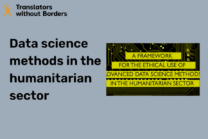
This framework is designed to highlight key ethical considerations, and to provide a practical guide for exploring or implementing advanced data science methods to support humanitarian outcomes. It serves to help humanitarian work stakeholders, and other private and civil actors learn how to ethically and responsibly use advanced data science methods in humanitarian work. View […]
Philippines Super Typhoon Rai (“Odette”) – Crisis language map
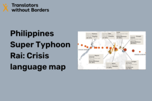
(Click here to open in a new window.) Typhoon Rai made an initial landfall in Siargao Island, province of Surigao del Norte in Caraga region, northern Mindanao on 16 December 2021. It carried gusts up to 270 km/h with maximum sustained winds of 195 km/h near the centre making it the strongest storm to make […]
Language diversity in the COVID-19 pandemic
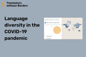
People have a right to access the information they need during the COVID-19 pandemic. Yet often that information is not available in languages and formats they understand. COVID-19 is rapidly expanding in linguistically diverse countries. Organizations supporting the response need to develop communication strategies that cater to the needs of marginalized language speakers in these […]
Interactive map: Global literacy levels
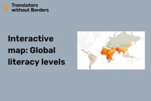
Explore our constantly updated interactive language map to learn about global literacy levels per gender per country.
Language guidance for communicating about COVID-19 in Northeast Nigeria

In need of words: Using local languages improves comprehension for people affected by Cyclone Idai in Beira, Mozambique
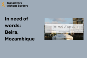
Read and download the report brief in English, Portuguese, Sena, and Chwabo.
Philippines Super Typhoon Mangkhut (“Ompong”) – Crisis language map
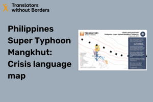
In the early hours of 15 September 2018, Typhoon Mangkhut struck the Philippines, with the eye of the storm crossing Luzon, the country’s largest and most populous island. The storm, locally known as Ompong, primarily impacted the northern Cagayan Province, including the towns of Baggao and Lasam, with sustained winds of 120 miles per hour […]
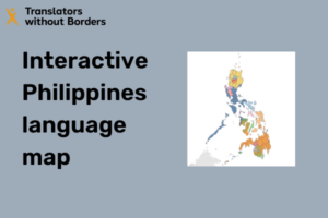
Interactive Philippines language map
Cyclone Kenneth in Cabo Delgado, Mozambique – Crisis language map
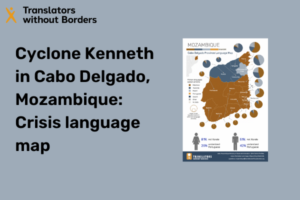
Cyclone Kenneth hit the northern part of the country on 25 April 2019, the strongest storm in Mozambique’s recorded history and the second in five weeks. Strong winds, rainfall, landslides, and flooding are expected at the time of writing, endangering lives and livelihoods. In the wake of Cyclone Kenneth, people affected need to obtain critical […]
Ebola outbreak DRC — Crisis language map
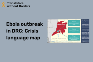
Carte linguistique en français On 8 May 2018, the government of the Democratic Republic of Congo (DRC) declared an outbreak of Ebola virus in Bikoro, Équateur Province. Preceding the declaration, two cases of Ebola had been confirmed by laboratory testing, and seventeen people had died in the past five weeks of suspected viral hemorrhagic fever. […]
Fuego volcano eruption Guatemala – Crisis language map
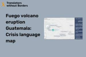
Erupción del Volcán de Fuego, Guatemala – Mapa lingüístico de la crisis en español On 3 June 2018, the Fuego volcano, 40 km from Guatemala City, erupted. Preliminary reports from CONRED, the national disaster authority, recorded 65 people killed and close to 2,000 people in shelters. More than 1.7 million people have been indirectly affected by the […]